Fledermaus Visualization Software |
Fledermaus is the industry leading interactive 3D geo-spatial processing and analysis tool. With the release of Version 7.0 we have moved this to the next dimension: the addition of a fully integrated time reference allowing users to work in a true 4D space and time environment. Commercial, academic and government clients use the Fledermaus software worldwide. They use the software to interact with massive geographical datasets of numerous data types for ocean mapping and land-based projects. The intuitive 4D display and interaction allows clients to rapidly gain insight and extract more information from their underlying data. This provides our clients with added value in data processing efficiency, quality control accuracy, data analysis completeness, and project integration, that promotes clear communication. |
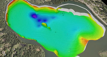
FM Viz 4D |
|||||
 |
• Fledermaus, Dmagic, FMCommand Op, Vessel Manager modules • Manuals and Training documentation on request • Dongle • First year of support maintenance |
||||
Annual Maintenance |
|||||
• Full technical support • Regular upgrades to the software (approximately every 4-6 weeks) |
|||||
Add-on Modules |
|||||
• FMGis • FMMidwater • FMGeocoder |
|||||
| For pricing, please contact MosaicGeo at sales@mosaicgeo.com | |||||
FM Habitat |
|||||
 |
• Fledermaus, Dmagic, FMCommand Op, Vessel Manager, Route Planner, FMGeocoder, FMGis modules • Manuals and Training documentation on request • Dongle • First year of support maintenance |
||||
Annual Maintenance |
|||||
• Full technical support • Regular upgrades to the software (approximately every 4-6 weeks) |
|||||
Add-on Modules |
|||||
• FMGis - included • FMMidwater • FMGeocoder - included |
|||||
| For pricing, please contact MosaicGeo at sales@mosaicgeo.com | |||||
FM Offshore |
|||||
 |
• Fledermaus, Dmagic, FMCommand Op, Vessel Manager, Route Planner modules • Manuals and Training documentation on request • Dongle • First year of support maintenance |
||||
Annual Maintenance |
|||||
• Full technical support • Regular upgrades to the software (approximately every 4-6 weeks) |
|||||
Add-on Modules |
|||||
• FMGis • FMMidwater • FMGeocoder |
|||||
| For pricing, please contact MosaicGeo at sales@mosaicgeo.com | |||||
FM Hydro |
|||||
 |
• Fledermaus(includes 3D Editor), Dmagic(includes PFM functionality), FMCommand Op, Crosscheck, Vessel Manager modules • Manuals and Training documentation on request • Dongle • First year of support maintenance |
||||
Annual Maintenance |
|||||
• Full technical support • Regular upgrades to the software (approximately every 4-6 weeks) |
|||||
Add-on Modules |
|||||
• FMGis • FMMidwater • FMGeocoder |
|||||
| For pricing, please contact MosaicGeo at sales@mosaicgeo.com | |||||
FM Pro |
|||||
 |
• Fledermaus, Dmagic, FMCommand Op, Crosscheck, Vessel Manager, Route Planner, FMGeocoder, FMGis, modules • Manuals and Training documentation on request • Dongle • First year of support maintenance |
||||
Annual Maintenance |
|||||
• Full technical support • Regular upgrades to the software (approximately every 4-6 weeks) |
|||||
Add-on Modules |
|||||
• FMGis - Included • FMMidwater • FMGeocoder - included |
|||||
| For pricing, please contact MosaicGeo at sales@mosaicgeo.com | |||||
Fledermaus Visualization Software Comparison Chart |
|||||
Features |
FM Viz4d |
FM Hitat |
FM Offshore |
FM Hydro |
FM Pro |
Cross-Platform: Windows, Mac & Linux |
|||||
Stereo-capable 4D visualization (split screen and full stereo) |
|||||
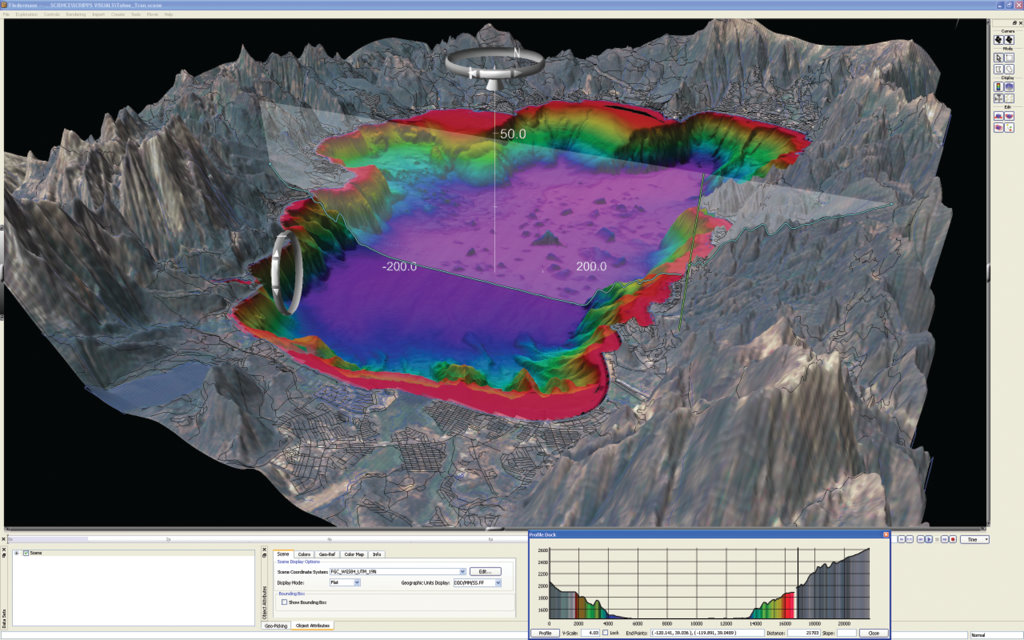
Create a 3D surface model and multivariate surfaces from a variety of ungridded and gridded data types |
|||||
Interpolate, mask, crop, or resample grids to get the best possible interpretation of the seafloor |
|||||
Import of ancillary data including imagery, ESRI shapefiles, AutoCAD DXF and DWG, points, lines, 3DS models, and ENCs |
|
||||
Drape sidescan mosaics, backscatter, charts, and other imagery onto surfaces |
|||||
Show object and surface change over time using time stamped data |
|||||
Perform slope, rate of change, and surface difference calculations |
|||||
Interactively digitize and label |
|||||
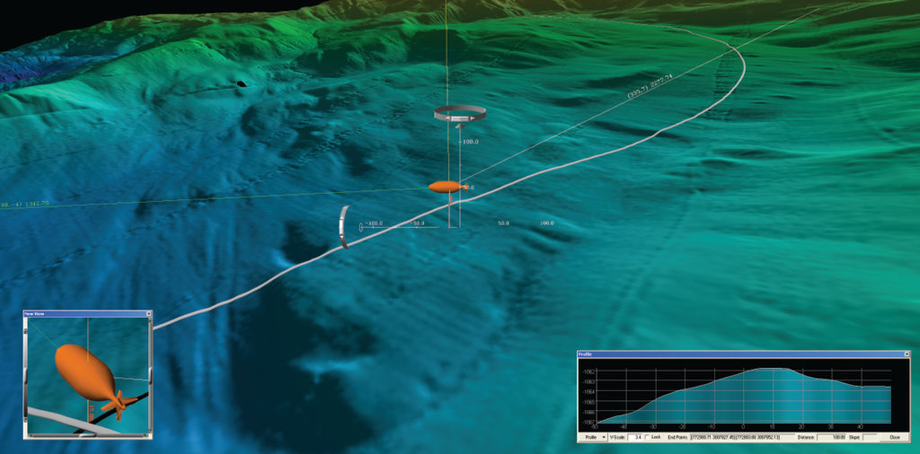
Real-time tracking of objects (vessels, animals, etc.) via serial cable, UDP packet, or logged string |
|||||
Generate and export points, lines, polygons, contours, grids in industry-standard formats |
|||||
Create editable key-framed flight-paths; output key frames or MPEG movies |
|||||
Produce high-resolution graphics for reports, posters, and publications |
|||||
Export Google Earth KML and KMZ files |
|||||
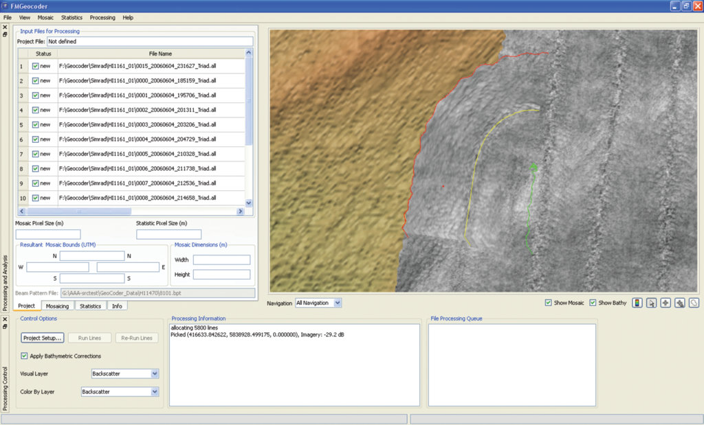
Create corrected backscatter data using FM Geocode |
opt. |
opt. |
opt. |
||
Semi-automated seafloor characterization |
opt. |
opt. |
opt. |
||
Analyze and interpret integrated bathymetry and backscatter data |
opt. |
opt. |
opt. |
||
Project and workflow management |
|||||
Interactively plan routes for pipelines and cables |
|||||
Calculate and export fixed pipeline length data files |
|||||
Generate and export long and cross profiles for use in engineering analysis |
|||||
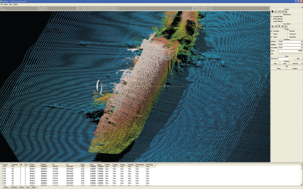
Import a variety of multibeam and lidar formats for area-based editing |
|||||
Flexible auto-processing of data with CUBE algorithm and filters |
|||||
State of the art QC and validation tools |
|||||
Sounding selection for database and charting |
|||||
Feature and contact selection and export |
|||||
Sounding, feature, and contact selection and export for database and charting |
|||||
Navigation surface (BAG) production and export |
|||||
Free Viewer for sharing and distribution of files |
|||||
Node-less surface interpretation tools |
|||||
Seamless workflow with integration of ArcGIS* software |
opt. |
opt. |
opt. |
||
Processing and analysis of multibeam and single beam sonar water-column data using FMMidwater |
opt. |
opt. |
opt. |
opt. |
opt. |
| * Integration with ArcGIS software requires an ArcGIS license, and is only available for Windows 32-bit systems. Trademark provided under license from ESRI.An evaluation copy of Fledermaus is also available to qualified applicants. To be notified when updates are released, join our mailing list. | |||||
